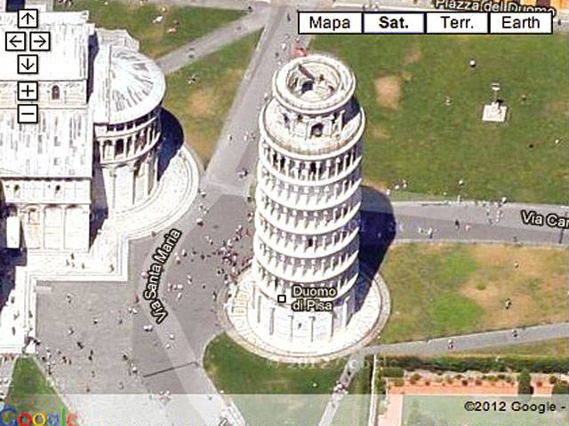
IF there’s one thing more frustrating than not being able to find your departure gate, it’s not being able to find the airport information map that shows you where to go.
But help is now at hand thanks to Google.
Its popular ‘maps’ service has been expanded to include the insides of a number of buildings to help people round transport hubs and football grounds.
The interactive maps are available online so people can plot their routes before they travel. One of the first places to be mapped was Manchester Airport and now passengers can see floorplans of the terminals to make their journey easier.
Anyone can view the graphics by logging on to the website - and bosses say they hope that getting lost in the departures hall will be a thing of the past as people will be able to receive directions through their mobile phones.
The airport’s three terminals can be viewed and passengers can even see different levels - finding out the exact location of shops, bars and restaurants.
It even pinpoints check-in desks, departure gates and information hubs, in an attempt to make the airport experience as easy as possible. Sara Joyce, the airport’s head of digital, said: ‘It is fantastic that Google maps have chosen us to be one of the first organisations on this new system. –MO
CONNECT WITH US
Now Google Maps lets you see inside buildings
ePaper
ePaper - Nawaiwaqt

NIPCO House, 4 - Shaharah e Fatima Jinnah,
Lahore, Pakistan
Tel: +92 42 36367580 | Fax : +92 42 36367005
Nawaiwaqt Group | Copyright © 2024
